Why Hosted Drone Data Makes Repeat Site Monitoring Easier
Managing a site over weeks, months, or years means comparing what has changed. For drone pilots and the clients who hire them, this often involves stitching together separate flights, matching up orthomosaics, and trying to spot differences by eye. The process becomes tedious and error-prone when each survey lives in its own folder on a local drive. A better approach is to store the data in a central, online environment designed for aerial imagery and spatial information. This article explains what hosted drone data is, how the workflow works, and what it means for anyone who needs to track a site over time.
What Hosted Drone Data Means
Drone data hosting is simply the practice of storing processed aerial outputs - orthomosaics, point clouds, elevation models, and project reports - on a remote server rather than on a local computer or a portable hard drive. The data can be accessed through a web browser or a map viewer, often alongside tools for annotation, measurement, and time-series comparison. Instead of emailing large files or burning drives, the pilot uploads the finished products to the hosting platform, and the client gets a link.
The key difference from cloud storage services like Dropbox or Google Drive is that the hosting platform is built for spatial data. It understands that an orthomosaic has geographic coordinates, that a point cloud needs a viewer that can rotate and measure, and that a project report might include multiple layers that need to align. A generic file folder treats everything as a blob, whereas a drone data hosting platform keeps the spatial context intact.
How the Workflow Works
The process starts with the capture. A drone pilot flies the site according to the project plan - grid patterns for mapping, oblique angles for structure inspection, or video passes for progress documentation. After the flight, the raw SD card goes into processing software that turns the individual images into stitched orthomosaics and point clouds. This step can take from minutes to hours depending on the site size and the number of images.
Once the processing is done, the pilot uploads the outputs to the hosting platform. This is typically a file upload through a web interface or an API. The platform then ingests the files, generates previews, and makes them available in the map viewer. The client receives a notification with a link. No software installation is required on the client side - just a modern browser and an internet connection.
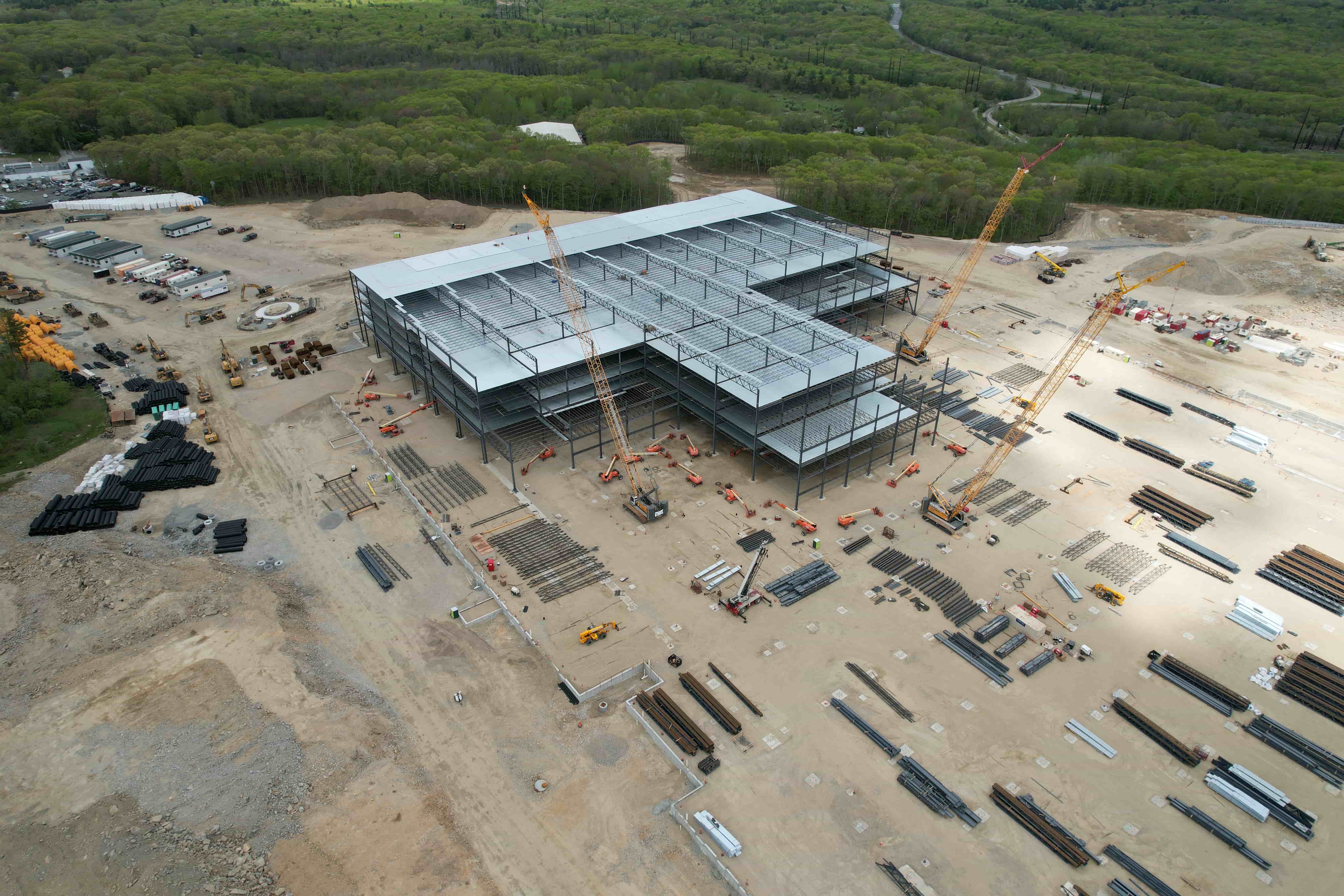
For repeat monitoring, the pilot repeats this cycle at regular intervals - weekly, monthly, quarterly, or after significant weather events. Each new survey is uploaded alongside the previous ones. The hosting platform stacks them in a time series, allowing the viewer to slide between dates or overlay them. This is where the value of hosting becomes clear: the client can see exactly how a stockpile changed, how a construction foundation progressed, or how vegetation encroached on a power line corridor.
Annotation and Reporting
Most drone data hosting platforms include annotation tools. A client can draw a polygon around an area of interest, add a note, and share that annotation with the pilot or a colleague. Measurements such as distance, area, and volume are often available directly in the viewer. Some platforms allow export of these annotations as PDF reports or shapefiles, which can be handed to engineers or regulators.
For a pilot, the hosting platform also serves as a portfolio and a delivery mechanism. Instead of sending a single file that the client might not be able to open, the pilot provides a link that works on any device. The client can explore the data without needing GIS expertise. This lowers the barrier to repeat business because the client does not have to learn new software each time.
What It Means for Repeat Monitoring
Repeat monitoring is about detecting change. Without a hosting platform, the typical workflow is to download each survey as a separate file, open them side by side, and try to remember what the site looked like last time. That is slow and prone to oversight. With hosted data, the time series is built into the viewer. The client can scrub through dates like frames of a movie, seeing exactly when a trench was dug, when a road was paved, or when a landslide occurred.
This visual comparison is not just convenient; it catches things that a written report might miss. A project manager looking at a weekly orthomosaic might notice that a drainage ditch has shifted slightly, even though the volume numbers look normal. The annotation tools allow marking that observation for follow-up. Over months, these small observations add up to a detailed record of site behavior.
For compliance and legal purposes, a hosted time series provides an auditable trail. Each survey has a date stamp and metadata about the flight parameters, processing settings, and file origin. If a regulatory body asks for proof of conditions on a specific date, the client can pull up the exact survey and share a read-only link. There is no risk of the data being lost or corrupted on a local drive.
National Drone Services offers a platform that allows FAA-certified pilots to upload their completed projects and deliver them to clients through a shared processing, hosting, visualization, and reporting environment. For a pilot who does repeat work for the same client, this means the client always has a single place to go for all historical surveys. The pilot does not have to re-send old files or worry about version confusion.
Practical Considerations for Pilots
Moving to a hosted workflow requires some planning. File sizes for orthomosaics and point clouds can be large - often several gigabytes per survey. The upload speed of the pilot's internet connection matters. Some platforms allow uploading overnight or in the background while the pilot works on other tasks. It is worth checking whether the platform supports resumable uploads in case the connection drops.
Another consideration is the hosting platform's data retention policy. Some platforms keep data indefinitely; others may archive or delete it after a period unless the client pays for extended storage. For repeat monitoring, the client needs to know that historical surveys will remain accessible. The pilot should clarify this with the platform provider before committing to a workflow.
Security is also relevant. Drone data often contains sensitive information about infrastructure, crop health, or security perimeters. The hosting platform should encrypt data in transit and at rest, and offer access controls such as password-protected links or user permissions. For government or defense clients, the platform may need to meet specific compliance standards. The pilot should ask about these details before uploading.
Finally, the pilot should consider the viewer experience on the client side. Some platforms work best on desktop browsers but struggle on tablets or phones. If the client wants to review surveys in the field on a mobile device, the platform should have a responsive design or a dedicated app. Testing this with a sample survey before the real project can save headaches later.
What It Means for Clients
For the client, hosted drone data removes the friction of receiving and managing large files. There is no need to install special software, no need to clear disk space, and no need to keep track of which version is the latest. The client can share a link with anyone on the team, including subcontractors who may need to see the data but do not have access to the client's network.
The time-series comparison is the biggest practical benefit. A construction manager can see whether the contractor is on schedule by comparing the current survey to the previous one. A mining engineer can track how much material has been removed from a pit. An environmental consultant can monitor wetland recovery after a restoration project. In each case, the data speaks for itself, and the hosting platform makes the comparison immediate.

Clients should ask the pilot how they plan to handle the hosting. Is the platform included in the project fee, or is it an extra cost? How long will the data remain accessible? Can the client download the raw files if needed? A clear understanding upfront prevents surprises later. For long-term monitoring projects, the client may want to contract for a full year of hosting with a set number of surveys, rather than paying per flight.
National Drone Services provides a shared platform where pilots and clients can work with the same data set. This means the pilot processes and uploads the data once, and the client can view, annotate, and export reports without going through the pilot each time. For repeat monitoring, this reduces the back-and-forth and gives the client more control over how they use the information.
Looking Ahead
As drone sensors improve and processing software becomes faster, the volume of data per survey will only increase. Hosted platforms that handle large point clouds and high-resolution orthomosaics will become the standard way to deliver aerial intelligence. Pilots who adopt a hosted workflow now will be better positioned to offer repeat monitoring services, and clients who use hosted data will find it easier to track changes across their sites.
The shift from local storage to hosted data is not just about convenience. It changes the relationship between the pilot and the client. Instead of a one-time transaction where the pilot hands over a file and moves on, the hosted model creates an ongoing connection. The client can revisit old surveys, request new flights, and build a cumulative picture of the site over time. That cumulative picture is what makes repeat monitoring truly useful.
For anyone managing a site that changes - a farm, a quarry, a construction project, a solar farm, a forest, a coastline - hosted drone data is a practical tool that makes the job easier. It eliminates the friction of file management and puts the focus where it belongs: on understanding what is happening on the ground.